 | ||
GENERAL DATA | PHYSICAL GEOGRAPHY | |
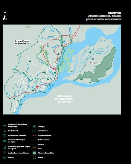
Geographical area | On the right bank of the Congo River, in the south-east of the country | Wealth of the site marked by the morphological diversity which has several advantages related to the presence: of a vast body of river water, including islands and suitable for navigation. |
Cooperation agreements | Dakar, Nouakchott, Windhoek, Tripoli, Rabat, Kinshasa, Changsha, Weihai, Milan, Jagodina, Rome, Elancourt,
Dresden, Reims | |
Department Name | Brazzaville (political and administrative capital of Congo) | |
Surface area : | 588,33 Km² | |
Total population : | 2 145 783 habitants(RGPH-5-2023) | |
Borders | The Pool Department on either side of the department and the Congo River (DR Congo) to the east. | |
Chief town | Brazzaville | |
Administrative distribution | Makelekele; Bacongo; Poto-Poto; Moungali; Ouenze; Talangai; Mfilou; Madibou; Djiri and the district of Ile Mbamou. | |
Prefect | Gilbert MOUANDA MOUANDA | |
Maire | Dieudonné BANTSIMBA | |
Official language | French | |
National language | Kituba and Lingala | |
Local languages | KONGO, MBOCHI, LINGALA, KITUBA, TEKE | |
Religions | Christians - Muslims & Animists | |
Main riches | Energy, Agriculture, Tourism, Manufacturing, Finance, Special Economic Zones, the Port of Brazzaville | |